


21
Albany Twp, M 16 L137.25 French HIll Rd - ±27 acre
Oxford County, Maine
± 27.00 Acres
$257,900


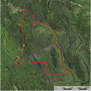
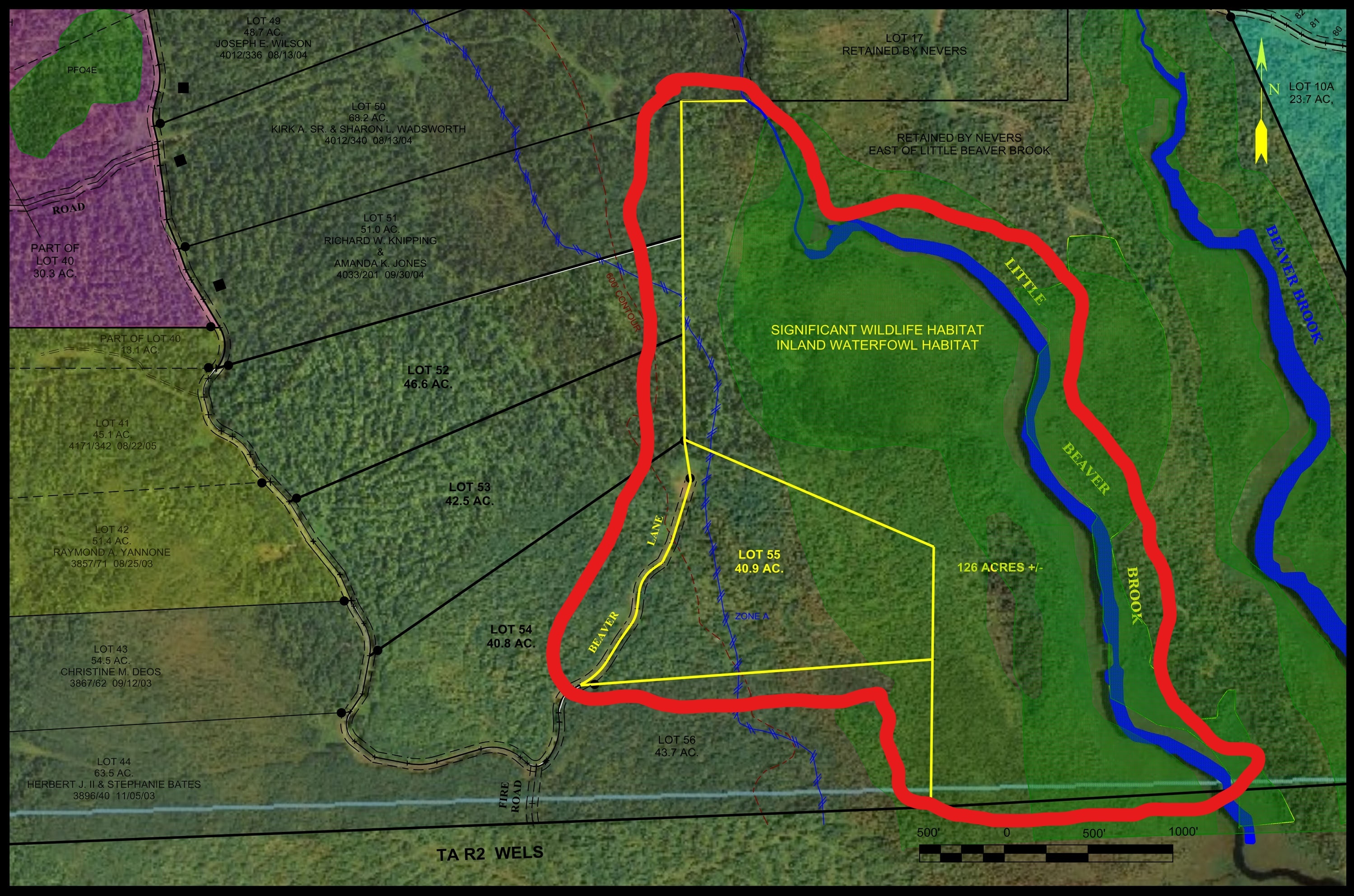
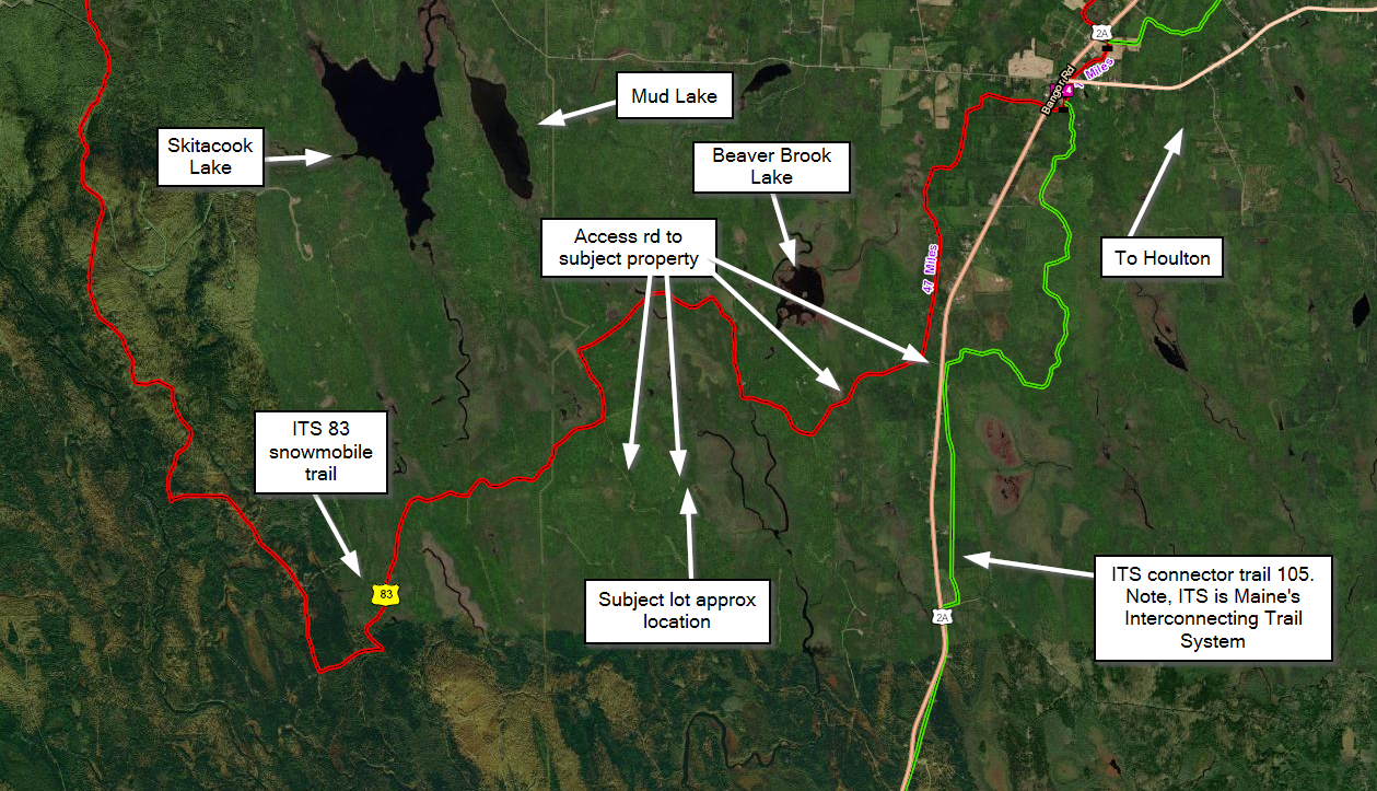
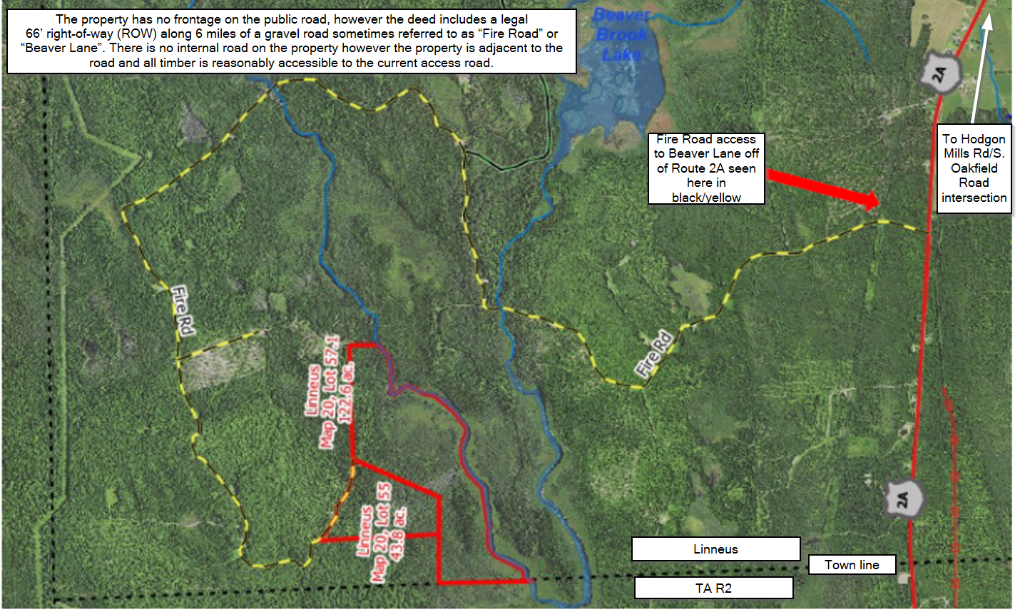
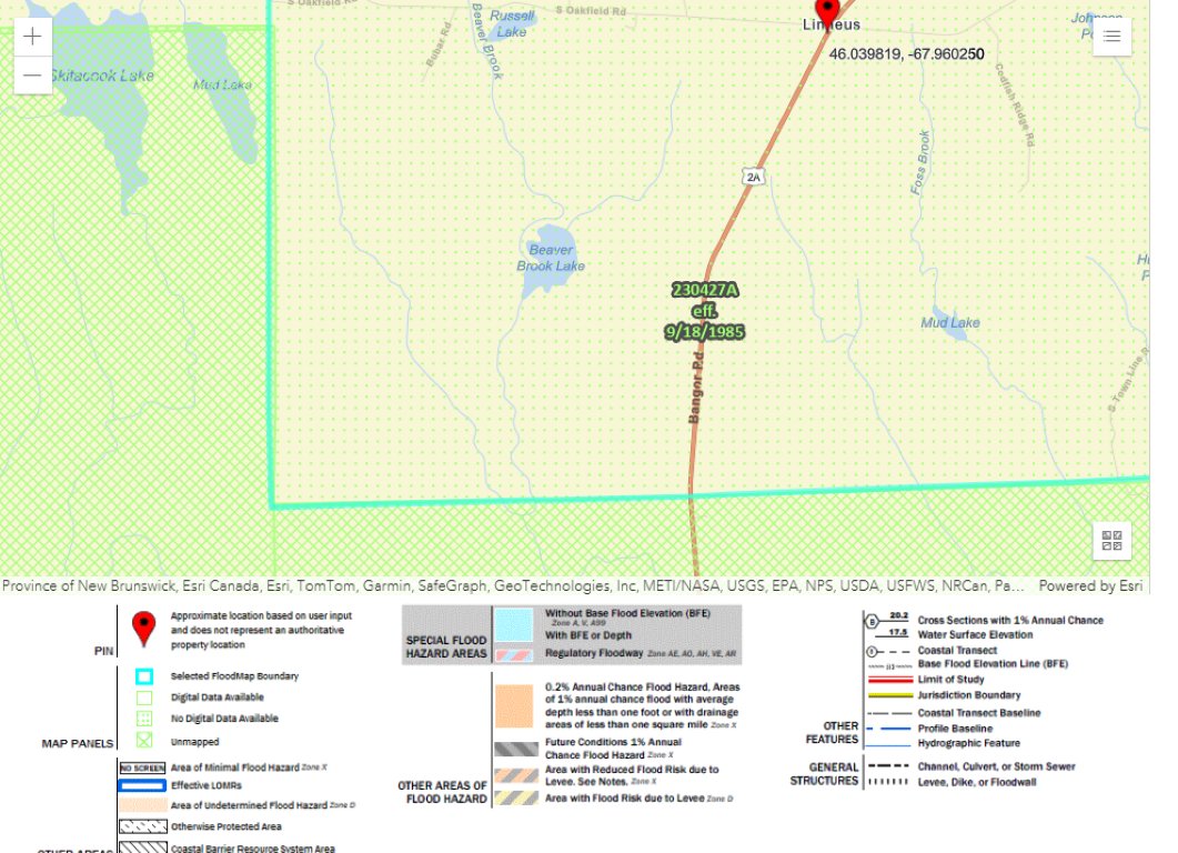
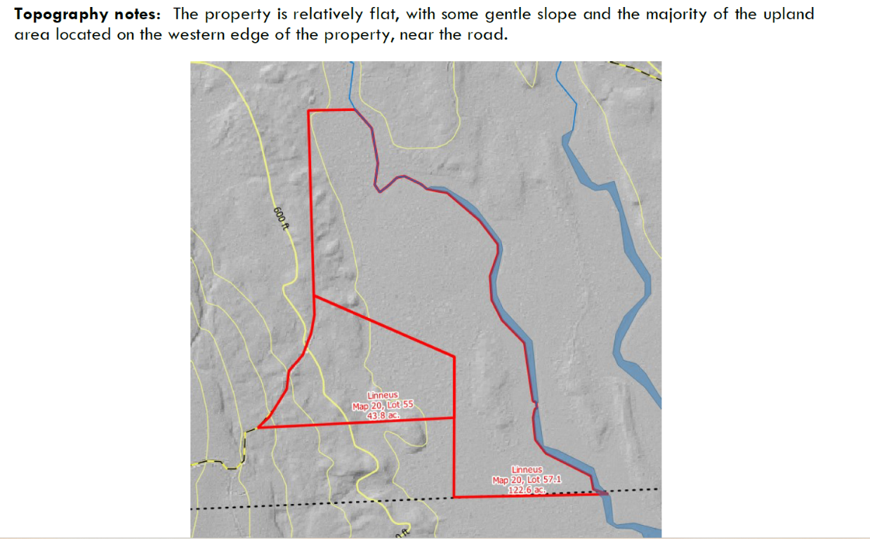
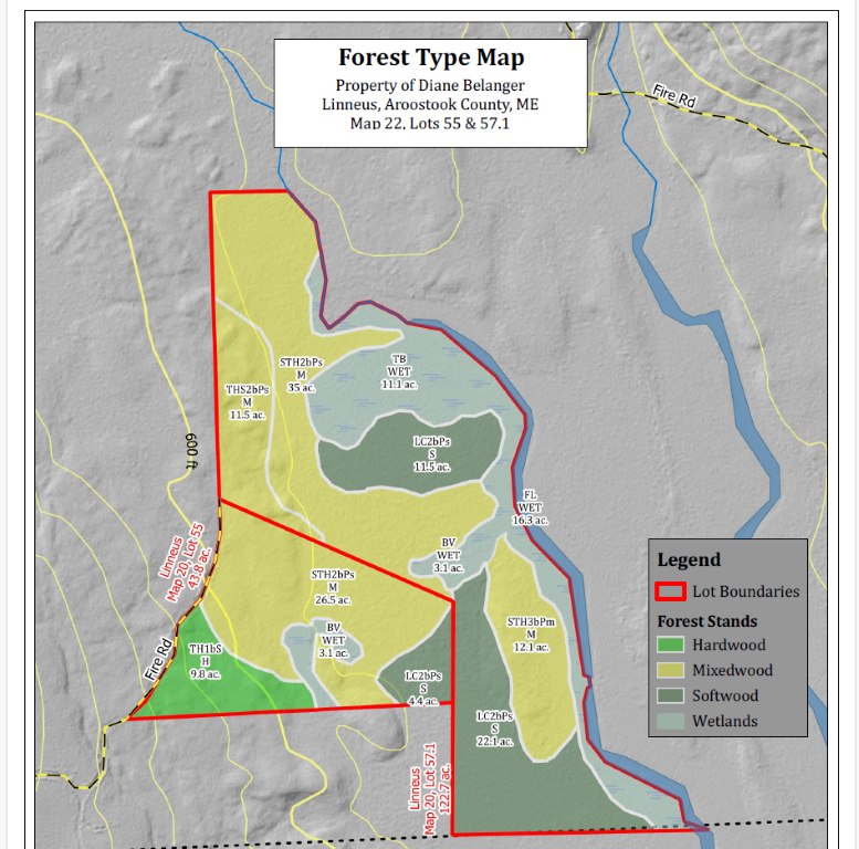
Linneus Beaver Lane
Listing Information
All information is assumed to be accurate and substantially correct but no assumptions of liability are intended. Neither the seller nor the agent or representatives warrant the completeness or accuracy of the information. Seller does not guarantee timber volumes, values, acreages (total, woodland/cropland, stand or otherwise), tree ages or the condition and/or function of any improvements, including but not limited to all buildings, machinery, appliances, wells, equipment, livestock and ponds. No representations or warranties are expressed or implied as to the property, its condition, boundaries or logging feasibility. Prospective buyers should satisfy themselves as to the accuracy of this information.
Real Estate
Sign in to favorite this property.
No account yet? No problem, Create an Account


